
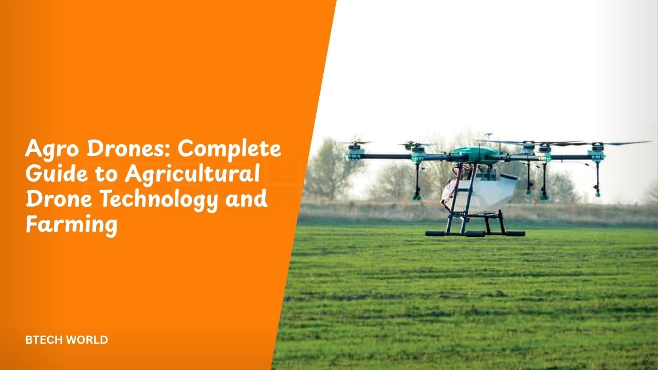
Agro Drones: Complete Guide to Agricultural Drone Technology and Farming

Agro drones are unmanned aerial vehicles designed or adapted to support farming and agricultural operations. Farmers can use them to collect aerial images, map fields, monitor crop health, identify stressed areas, assess irrigation needs, and perform targeted spraying. The technology has become an important part of precision agriculture because drones can provide detailed information from above and help farmers make more targeted decisions.
Modern agricultural drones can do more than simply capture photographs. Depending on the system, they can carry RGB, multispectral, thermal, or other sensors and use GPS-based flight planning to collect information from specific areas. Some specialized drones also carry tanks and spraying systems for targeted applications. These capabilities connect aerial data with practical farm operations.
What Are Agro Drones?
Agro drones are UAVs used for agricultural tasks such as crop monitoring, mapping, spraying, soil assessment, and field inspection. They can operate through remote control or follow pre-planned routes, allowing farmers and agricultural service providers to cover fields systematically. Their value comes from combining aerial mobility with cameras, sensors, positioning systems, and software.
Unlike conventional drones used mainly for photography, agricultural models are built around specific farming requirements. Some are lightweight observation platforms, while others are larger machines designed to carry liquid or granular payloads. The right type depends on whether the farmer needs information, physical field treatment, or both.
How Agro Drones Work
An agricultural drone normally combines a flight system, navigation technology, sensors, batteries, and software. Before a mission, the operator can define the field or area that needs inspection. The drone then follows a planned route while capturing images or collecting sensor measurements at selected locations.
After the flight, software can organize the collected information into maps, images, measurements, or other useful outputs. More advanced systems can connect drone data with artificial intelligence, geographic information systems, and other agricultural technologies. This can help turn raw aerial observations into information that farmers can use for field decisions.
Main Types of Agricultural Drones
Agricultural drones come in several configurations. Multirotor drones are useful for detailed inspection because they can hover, change direction quickly, and operate at relatively low altitudes. They are commonly suited to smaller areas, targeted scouting, and operations where precise positioning is important.
Fixed-wing drones can cover larger areas efficiently because their aircraft-style design supports longer flight patterns. Hybrid systems combine characteristics of fixed-wing and multirotor aircraft. Spray drones are another specialized category, carrying tanks and application equipment for targeted treatment. Each design involves different trade-offs in coverage, payload, flight time, maneuverability, and operating requirements.
Crop Monitoring With Drones
Crop monitoring is one of the most established uses of agricultural drones. A drone can capture repeated images of a field and help farmers identify differences in plant growth, vegetation density, or visible stress. Repeated flights can also show how conditions change during a growing season.
This aerial perspective can be especially useful when fields are large or difficult to inspect on foot. FAO reports that agricultural drones can support crop monitoring, mapping, field assessment, and early identification of stressed areas, pests, diseases, and weeds.
Multispectral and Thermal Imaging
Standard cameras capture visible light, but agricultural drones can also use specialized sensors. Multispectral cameras collect information from selected portions of the electromagnetic spectrum, helping analysts examine vegetation characteristics that may not be obvious in ordinary photographs. Thermal sensors can provide information related to temperature differences across a field.
These technologies can help identify areas that deserve closer inspection. For example, thermal imagery can contribute to irrigation assessment, while multispectral information can support crop-health analysis. However, sensor data still require appropriate interpretation because an unusual image does not automatically identify one specific cause of crop stress.
Field Mapping and Surveying
Agro drones can create detailed aerial maps of agricultural land. A planned flight can capture overlapping images that software processes into maps or three-dimensional representations. Farmers can use these outputs to understand field boundaries, terrain, crop distribution, and other physical characteristics.
Mapping can also support planning before planting or other farm activities. FAO notes that modern agricultural drones can use flight-planning software and GPS to follow automated routes while capturing images at planned locations. This makes systematic field mapping more practical than relying only on occasional manual observations.
Precision Spraying
Spraying is one of the most important mechanical applications for agricultural drones. Specialized spray drones can carry crop-protection products and apply them over targeted areas. Their ability to fly at controlled heights and follow planned paths can support more precise applications, particularly in locations where conventional machinery is difficult to operate.
USDA research is examining agricultural spray drones with the goal of improving productivity, precision, and environmental performance. Research programs include evaluating drone spraying across different field conditions and developing approaches for more effective application and data management.
Pest and Disease Detection
Drones can help farmers inspect crops for signs of pest activity, disease, or other problems. Instead of manually examining every part of a large field, aerial imagery can highlight areas that deserve closer attention. Farmers can then investigate those locations and decide whether further action is necessary.
FAO’s 2026 work on agricultural drones describes their use for pest surveillance, early detection, identification of infestation hotspots, and targeted application of chemical or biological agents. This approach can support more localized intervention instead of treating an entire field without considering differences between areas.
Irrigation and Water Management
Water management is another area where drone technology can provide useful information. Thermal sensors and other imaging technologies can help identify differences across fields that may indicate areas requiring further investigation. Farmers can combine aerial observations with ground measurements and irrigation data.
The goal is not simply to collect more images. The useful outcome is better information about where resources may be needed. FAO identifies irrigation assessment as one agricultural application of drones, including the use of thermal sensors to identify dry areas and vegetation information to assess crop conditions.
Soil Analysis and Field Assessment
Drones can support soil and field analysis by creating aerial maps and collecting information across agricultural land. These maps can help farmers understand variations in terrain, field boundaries, and other characteristics that influence farm management.
Aerial information does not replace laboratory soil testing in every situation. Instead, it can complement ground-based measurements by showing where differences may exist across a large field. USDA documentation also identifies UAV use for soil analysis and 3D mapping as agricultural applications.
Seeding and Planting
Some agricultural drone systems are designed for seeding or planting-related operations. These systems can distribute seeds or specialized planting materials over selected areas, depending on the crop and technology involved. Drone-based planting is particularly interesting where terrain or access makes conventional equipment difficult to use.
FAO identifies planting and seeding among agricultural drone applications, while newer agricultural systems are exploring automated and targeted deployment. These applications remain dependent on crop type, field conditions, payload requirements, local regulations, and the specific equipment being used.
Benefits of Agro Drones
Agro drones can save time by covering agricultural areas from the air and quickly collecting information. They can also reach locations that may be difficult for tractors or people to access, particularly when fields are wet, uneven, or densely planted. This makes aerial inspection useful for both routine monitoring and rapid field assessment.
Another benefit is targeted intervention. Instead of treating an entire field in the same way, drone data can help identify areas that require attention. When combined with suitable application systems, drones can support more precise spraying and other field operations.
Agro Drones and Precision Agriculture
Precision agriculture focuses on managing fields according to variations in crops, soil, water, pests, and other conditions. Agro drones fit this approach because they can collect detailed information at relatively low altitude and at different points during a growing season.
The information can be combined with GPS, GIS, remote sensing, artificial intelligence, and other farm technologies. USDA research describes UAVs as useful platforms for low-altitude remote sensing, while newer projects are exploring autonomous systems that can monitor crops and weeds and direct targeted spraying.
AI and Agro Drones
Artificial intelligence is becoming increasingly relevant to agricultural drone systems. Instead of relying only on human inspection, software can analyze large collections of aerial images and identify patterns that may require attention. AI can potentially help classify plants, detect weeds, identify stressed areas, and prioritize field inspections.
USDA research projects are exploring autonomous UAV systems that use specialized cameras, collaborative flight, and automated analysis to monitor crops and weeds. These projects illustrate how agricultural drones may move from simple image collection toward integrated systems that connect sensing, analysis, and field action.
Agro Drone Technology and Automation
Automation can make agricultural drone operations more systematic. Flight-planning software can define routes, while GPS and onboard systems help the aircraft maintain its planned path. Automated workflows can reduce the amount of manual flying required during repetitive field surveys.
Future systems may connect drones with farm management platforms and other connected equipment. The objective is to create a cycle in which drones collect information, software analyzes the results, and farmers use that information to guide field operations. The level of automation depends on the equipment, software, regulations, and operating environment.
Agro Drones for Small Farmers
Smallholder farmers can also benefit from drone technology, but purchasing and operating a complete drone system may not always be practical. FAO’s 2026 review of more than 100 drone-related initiatives examined different ways to make agricultural drones more accessible to small-scale producers in Europe and Central Asia.
Service-based models can provide another option. Instead of owning the aircraft, farmers can hire trained operators or agricultural service providers to perform mapping, monitoring, or spraying missions. This approach can reduce the need for farmers to purchase equipment, maintain batteries, learn flight operations, and manage every technical aspect themselves.
Challenges of Using Agro Drones
Agricultural drones have limitations that farmers should consider before investing. Weather can affect flight operations, especially strong wind, rain, heat, or poor visibility. Battery capacity also limits how much area a drone can cover during one flight, while large farms may require multiple batteries, aircraft, or carefully planned missions.
Data management can create another challenge. High-resolution imagery can generate large amounts of information that require suitable storage, processing software, and technical knowledge. Farmers may also need trained operators who understand both drone operation and agricultural interpretation.
Regulations and Safety
Drone operations are subject to aviation and agricultural rules that vary by country and region. Requirements can cover registration, pilot qualifications, operating altitude, restricted areas, visual line of sight, spraying procedures, and the use of agricultural chemicals.
Farmers should therefore check the rules of their local aviation and agricultural authorities before operating a drone. FAO has highlighted the importance of regulatory frameworks for agricultural drone use, particularly as adoption expands in different countries.
Agro Drones vs Traditional Farming Equipment
Traditional agricultural machinery remains important for many farming operations. Tractors, sprayers, harvesters, irrigation systems, and other equipment can perform tasks that drones cannot replace. Agro drones are generally most useful when they complement existing equipment rather than being treated as a universal replacement.
Drones have particular advantages in aerial observation, targeted operations, and access to difficult areas. Ground equipment can carry larger loads and perform heavy physical work for extended periods. Combining both approaches can allow farmers to use aerial information to make better decisions while retaining conventional machinery for tasks that require substantial power or capacity.
Agro Drones and Environmental Efficiency
Targeted agricultural operations can potentially reduce unnecessary inputs when farmers use accurate field information and appropriate application methods. FAO describes agricultural drones as tools that can support more precise use of water and crop-protection inputs, while USDA research is investigating ways to improve the efficiency and environmental performance of drone spraying.
However, drones do not automatically make every agricultural operation sustainable. Environmental outcomes depend on flight planning, product selection, application settings, weather, operator training, and compliance with agricultural regulations. Technology is one part of a broader farm-management system rather than a guarantee of reduced environmental impact.
Future of Agro Drones
The future of agricultural drones is likely to involve stronger connections between aerial sensing, AI, autonomous flight, and farm-management software. Research is already exploring drone swarms, automated crop monitoring, weed detection, and targeted spraying. These systems could allow multiple small drones to collect information while specialized aircraft perform selected field operations.
Sensor technology is also expanding the amount of information drones can collect. Multispectral, thermal, and other sensors can provide different views of crop and field conditions. As these systems become more integrated, the focus will increasingly move from simply flying drones to using aerial data as part of a complete precision-agriculture workflow.
Agro Drones: Key Applications at a Glance
| Application | How Drones Help | Main Benefit |
|---|---|---|
| Crop Monitoring | Capture aerial images and sensor data | Faster field inspection |
| Field Mapping | Create detailed maps and models | Better farm planning |
| Spraying | Apply products to targeted areas | More precise application |
| Pest Detection | Identify suspicious or stressed areas | Earlier investigation |
| Disease Monitoring | Track visible crop changes | Faster response |
| Irrigation Assessment | Detect field variations using sensors | Better water management |
| Soil Analysis | Support aerial mapping and assessment | Improved field information |
| Seeding | Distribute seeds in selected areas | Access to difficult locations |
| Damage Assessment | Survey storm, flood, or other damage | Faster evaluation |
| Weed Detection | Identify potential weed locations | Targeted treatment |
Conclusion
Agro drones are becoming an important technology within modern precision agriculture. They can support crop monitoring, mapping, pest detection, irrigation assessment, spraying, seeding, and damage evaluation. Their biggest advantage comes from the ability to collect detailed information quickly and, with specialized equipment, perform targeted field operations.
The technology is also moving beyond basic remote-controlled aircraft. AI, multispectral and thermal sensors, autonomous flight, GPS, GIS, and connected farm systems are creating more integrated agricultural workflows. For farmers, the most useful drone is not necessarily the most advanced model, but the system that fits the crop, field size, operation, budget, local regulations, and available technical support.
Frequently Asked Questions
What are agro drones?
Agro drones are unmanned aerial vehicles used for agricultural tasks such as crop monitoring, mapping, spraying, pest detection, irrigation assessment, and field analysis. Some models are designed primarily for sensing, while others can carry agricultural payloads.
What are agro drones used for?
Agro drones can be used for crop monitoring, field mapping, soil assessment, pest and disease detection, irrigation analysis, targeted spraying, seeding, and agricultural damage assessment. The exact capabilities depend on the drone, sensors, software, and payload system.
Can agro drones spray pesticides?
Yes, specialized agricultural spray drones can carry and apply crop-protection products. Their use must follow applicable agricultural and aviation regulations, and safe application depends on appropriate equipment, operator training, weather conditions, and product instructions.
How do drones help precision farming?
Drones provide aerial information that can reveal differences in crop health, vegetation, moisture conditions, pests, weeds, and field characteristics. Farmers can combine this information with GPS, GIS, sensors, and other technologies to support more targeted management decisions.
What is the future of agro drones?
The technology is moving toward greater automation, AI-based analysis, improved sensors, autonomous monitoring, and coordinated drone systems. Current USDA research includes autonomous UAV concepts for crop and weed monitoring combined with targeted spraying, showing how agricultural drones may become more integrated with precision-farming workflows.
Explore More: BTECH WORLD